I am haunted by waters.
Norman MacLean, A River Runs Through It, 1976
Can rivers tell stories?
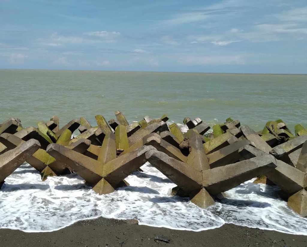
In 2010, Jane Bennett published Vibrant Matter: A Political Ecology of Things where she advocates for a posthumanist imagination. Non-humans have active agency within an assemblage. Perhaps that line of thinking can be extended to a host of more-than-human entities such as rivers. As Dominique Sasha Amorsolo found out from her field research in the lower Abra River in 2019, rivers tell stories of their morphological histories as charted by their flows and directions. If rivers can tell stories, Amorsolo was there to document and assist in visualising trajectories and liminalities.
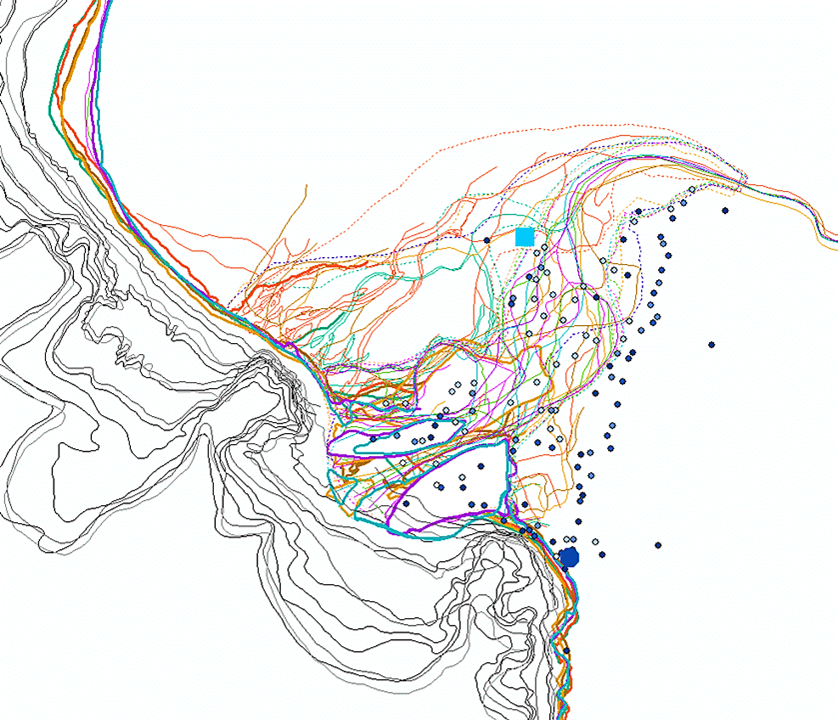
An assistant professor specialising in physical geography and geohumanities, Amorsolo produced an imaginative countermapping of traditional knowledge and historical records of the lower Abra River and the townspeople of Santa. The map relied on place-based stories and geonarratives countermap that represent more than one hundred years of history of the river-town. The present map relied on GIS that shows the lower Abra River and the community of Santa as entangled bodies. This map is in response to the more than 50 maps that she generated in GIS as visual support for her thesis research findings. It is a map of all remaining aggregated GIS-enabled data. By participating in the politics of scientific representability in cartographic works, Amorsolo used GIS, the “default” and “accepted” technological advancement in creating State-institutionalized maps and mapping standards. Creating a countercartographic output is a form of resistance by employing the tool in going against entrenched conventions. For this map, ArcMap as the GIS software program was used. Created by Esri (Environmental Systems Research Institute), the ArcGIS Suite (where ArcMap is included) is arguably the most recognized and most powerful GIS technology recognized by specialists and practitioners due to its robust functions, multiple features, and price tag.
In the map, the colored line networks are a visual representation of the life-story of the lower Abra River from a span of 113 years (1903-2016), and how it is intermingled with the various barrios/barangays (and town center) of Santa. Gearing away towards the concept of framing time with specific periods, the dots in the map correspond to migrations and dissolution of the barangays within 113 years – regardless of whether they were already washed away by floods, relocated to a different location in Santa, or continues to remain at their present sites. The larger sky-blue square symbolizes the former location of the town center, with its shape reflecting its grid street pattern. The navy-blue octagon is the municipal center’s present location and current street pattern. Amorsolo mapped the river and the town as intertwined embodiments to show how these lifeworlds are entangled and interwoven, and how these human and more-than-human entities have life-stories to express equally important and significant ‘facts’ (as non-human bodies like rivers serve to assist as mere backdrops or settings to people’s narratives and experiences). Amorsolo eliminated all that is typically considered as basic map elements one would often see in a map: the map title, labels and legends, scale, directions and arrows, map projection, hypsometric tints, author’s name, date published/created, data references, and borders –all of which can be seen in my river basin map. Just as how in reality, this river-town fluvialscape is bounded by various anthropocentric intrusions –from the mere labeling and categorizing of features on the map to the visual hierarchies between human and more-than-human entities. In removing these map elements, Amorsolo showed how maps can be a tool for ‘unbinding’ anthropocentric mediations into the more-than-human and landscapes.
Aside from these, the intermingling of the aquatic and terrestrial was also expressed in this creative intervention as both white spaces as not to form divided representations (i.e., blue for the waters of the West Philippine Sea and the lower Abra River and brown/green for the terrestrial land area). Amorsolo also used multiple colors for the river networks to go against the conventional use of different shades of blue for waterways, while intendedly applying an assortment of shades of blue to correspond to the comings and goings of the barangays and town center along with the river with time. The life-stories of the river and town are all epitomized in one single map to show how both have, and will continue to, leave imprints into the landscape – a series of created complex, dynamic, and interacting palimpsestic strata of meaning (Viles and Goudie, 2010).
To read more stories of lower Abra river, read Amorsolo’s article in Banwaan where the narrative above was taken almost verbatim (except for occasional stylistic detours).
DSN Amorsolo & JS Palis
15 November 2023
References
Bennett, J (2010). Vibrant Matter: A Political Ecology of Things, Durham: Duke University Press.
MacLean, N (1976). A River Runs Through It and Other Stories, Chicago: University of Chicago Press.

Leave a comment