“Collectively produced by the efforts of ordinary people rather than by a political class of professionals following pregiven political strictures … maps … serve as a testament to the political potentials of those from below … to create a world where they can finally fit.”
Linda Quiquivix, “Art of War, Art of Resistance”, 2014
The late cartographer John Brian Harley (2002) once said that maps should be seen as a language of power in that context, selectivity, practice and political statements are communicated in the geographical and place-based representation of particular situations.
In a social action-research project in Negros Island undertaken by individuals working in the academe and communities, the maps derived by the group become discursive, in that they do not just represent and locate, they also appraise, evaluate and persuade. So while maps show locational data, in the case of human rights defenders (HRDs) who constantly live/die in these precarious geographies, how can their narratives be portrayed without revealing their spaces? How does one one calibrate information without disclosing too much? How can maps be created that aim to hide?
This dilemma leads to a surreal map designed not to tell actual locations of violence but stories of everyday vulnerabilities faced by HRDs. The map abstracts general points of interest to denote how seemingly normal and safe spaces for everyone may be dangerous and even fatal for HRDs.
In an article published by three of the five researchers in 2022, they stated:
“The sensitive nature of the experiences shared by the HRDs posed a grave
threat to their well-being and safety and identifiable location markers were
purposely removed from the research. The precarity of the conditions of the
participants required that we do away with the locational specificity that can be afforded by GIS. Due to the risks faced by HRDs from multiple perpetrators,
locational data was concealed and obscured to refrain from the identification of the participants’ whereabouts” (De Guzman, Lopez & Ortega, 2022, p. 10).
The two maps included here tell stories of safe spaces and landscapes of terror.
These cartographic outputs arise from the human rights defenders’ mental maps of everyday geographies and lived experiences.
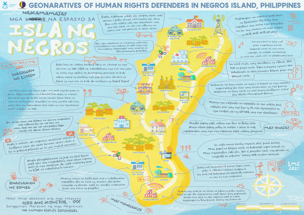
Map 1: Unsafe spaces according to human rights defenders in Negros Island, 2021, LM Garcia
Map 1 depicts violent geographies ranging from physical to epistemic violence. Written in Filipino and English, the stories are detailed accounts ranging from storying outright massacre to the deployment of CCTV (closed-circuit television) to surveil the routes of social movements and are meant to intimidate and harass.

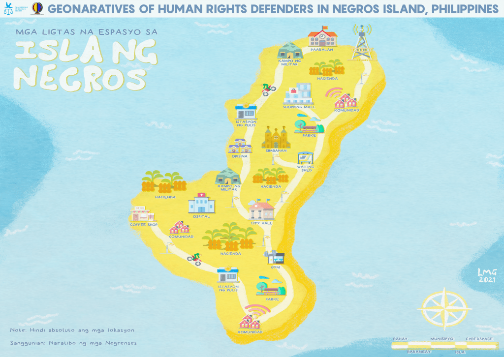
Map 2: Safe spaces in Negros Island, 2021, LM Garcia
Map 2 is notable for the absence of stories about safe spaces. As one HRD jokingly asserts: “I did not indicate a safe space, I could not see any, maybe in outer space.” (De Guzman et al, 2022, p. 15).
Ultimately, these art maps function as a contestation of space illustrated from the standpoint of HRDs. Contrary to the notion of a safe Negros Island spun by the state and mainstream media, vandalizing and destabilizing the map symbolizes the HRDs’ exposition of their struggles and reclamation of just and democratic spaces.
This art map is part of a map series for the study entitled Geonarratives of Human Rights Defenders in Negros Island, Philippines. The study is funded by the Commission on Human Rights of the Philippines, and is a collaborative effort between the Department of Geography, University of the Philippines Diliman and the Department of Geography and the Environment, Syracuse University.
JS Palis, MT De Guzman, BS De La Cruz, LM Garcia, YP Lopez, AA Ortega
December 31, 2023
References
De Guzman, MT; Lopez, YP & Ortega, AA (2022). Geonarratives of Human Rights Defenders (HRDs) in Negros Island, Philippines, Banwaan: The Philippine Journal of Folklore, 2(1), 1-24.
Harley, JB (2002). The New Nature of Maps: Essays in the History of Cartography, Baltimore, MD: Johns Hopkins University Press.
Quiquivix, L (2014). Art of War, Art of Resistance: Palestinian Counter- Cartography on Google Earth, Annals of the Association of American Geographers, 104:3, 444-459, DOI: 10.1080/00045608.2014.892328

Leave a comment