Through the years, the UP Department of Geography has produced and collected maps and other cartographic works in cartography and geography courses, and in other extension- related community-based undertakings. The maps are not only communicative tools that aid in enabling the visibility of stories from various landscapes (physical, social, imaginative), these maps also illuminate power relations that exist between individuals, institutions and other collectives through narratives and stories. Most of these maps are stored in multiple repositories (various websites, cartography library, reports) in analogue and digital formats. Some of the physical maps are in poor condition that need to be digitized inorder to present them (and the contexts when these maps are created and produced) in clearer and better resolutions. In celebration of the 40th anniversary of the UP Department of Geography (1983-2023), the present project aims to gather and collate the extant maps as evidence-based narratives how the Department changed through the years. The changes not only reflect the shift from paper (vellum) to GIS-based online maps but also document the various approaches and map-making practices that assist in telling a more complete history of Geography as a discipline in the Philippine archipelago. The present project simultaneously taps into the preservation of maps that encapsulate data and information of a given place and situation in a website, but also in providing an ‘emotional turn’ in cartography that considers the role of affect the creation of these cartographic representations. Maps are, after all, representations of subjective realities even if they are conventionally regarded as ‘objective and neutral’.
The proposed project aims (1) to gather the maps produced by the Department of Geography and collectively feature them in a website devoted towards showcasing cartographic works by faculty and students. These maps are (2) to be curated to spotlight the stories and narratives stemming from the visible information produced by the map, but more importantly to also tell the stories of various map-making practices and the contexts where and when the maps were created and produced. Consistent with the popularization of various map stories and the map-making practices, the website is hoped to be of use in geography classes for pedagogical and research purposes. These maps will likewise be featured and curated in various social media and online platforms of the Department of Geography to increase their visibility to K-12, intermediate and collegiate students to widen, augment and enhance their knowledge on geography as a discipline, and in cartography as a field of interest.”
– J Palis; Excerpted from OICA proposal
-

Road ecologies and transport geographies
[T]he study of mobility and transport reveals existing power relations and offers opportunities to challenge those relations. Julie Cidell, José Acosta-Córdova, Andrea Pimentel Rivera & Ricardo Zapata, “Critical geographies of transport and mobility”, 2021, p. 2 Transport geographies has a long history that predated the arrival of traditional conveyances and modern-day vehicles. The mobilities community… Read more
-
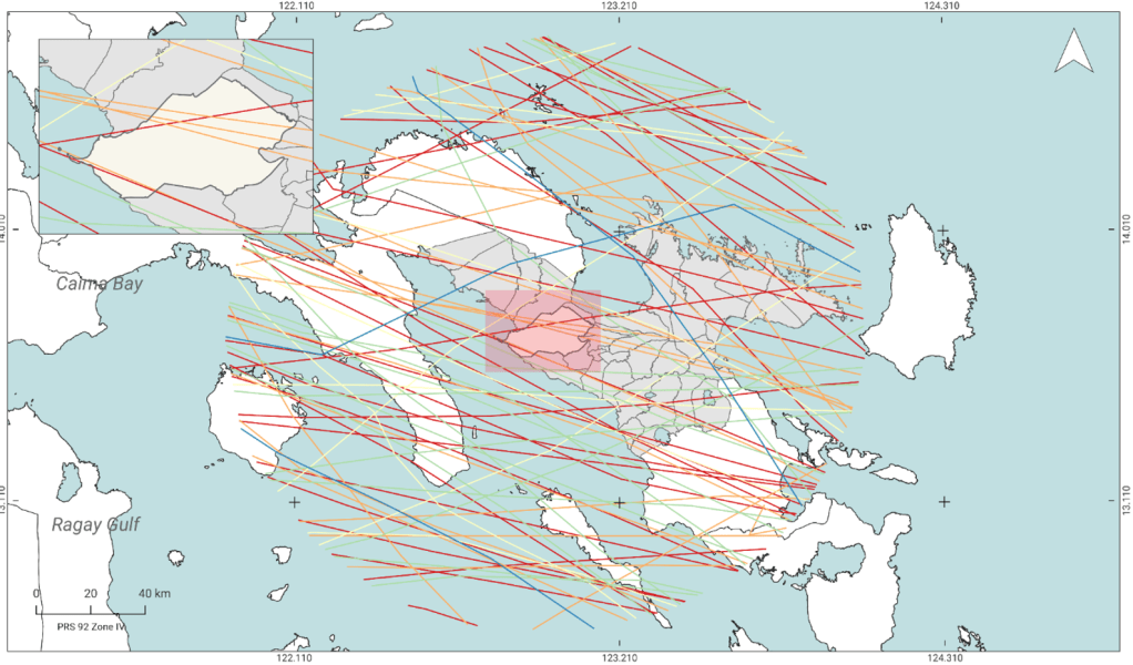
‘Hazardous’ cartographies
There is a map for everything. Even in identifying hazards and attendant vulnerabilities in communities. During Midyear Term 2023, the UP Department of Geography conducts an extension program through its Geography 192 course (Field Methods in Geography). The program was instituted in the 1990s and involves faculty and undergraduate students providing technical assistance and utilizing… Read more
-
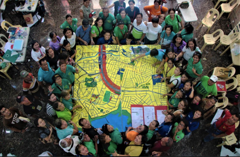
Meaning-making in community cartographies
Participatory mapping has proven to be effective in generating the diversity of how different local communities view disasters, vulnerabilities, and other concepts related to DRR. Emmanuel Garcia, “Of Disasters and Participation”, 2021 Maps started out from the graphic representation of the earth. They were (and continue to be) rendered as 2-D maps as a convenient… Read more
-
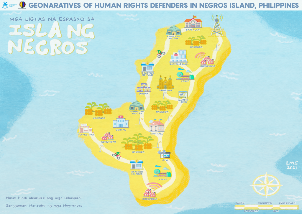
The precarious lives of human rights defenders
“Collectively produced by the efforts of ordinary people rather than by a political class of professionals following pregiven political strictures … maps … serve as a testament to the political potentials of those from below … to create a world where they can finally fit.” Linda Quiquivix, “Art of War, Art of Resistance”, 2014 The… Read more
-
This bird has flown
How do scientists survey the number of birds in a given area? In a highly cited paper by Ben Vallejo, Alexander Aloy and Perry Ong (2009) on bird mapping, they employed several approaches and methodologies in mapping urban birds in Metro Manila. One approach involved a lot of fast-paced walking: We conducted the surveys by… Read more
-
The river runs
I am haunted by waters. Norman MacLean, A River Runs Through It, 1976 Can rivers tell stories? In 2010, Jane Bennett published Vibrant Matter: A Political Ecology of Things where she advocates for a posthumanist imagination. Non-humans have active agency within an assemblage. Perhaps that line of thinking can be extended to a host of… Read more
